
Cover Story
From antiquity to anarchy: the growth of Bombay – I
At a two-day seminar organized by the K. R. Cama Oriental Institute architects and historians traced the growth of the city through its architectural achievements
The story of the building of Bombay that emerged from the papers presented at the seminar on "Architecture as social history: Reflections on Bombay/Mumbai” manifested ideas of town planning, the available techniques as well as the circumstances that necessitated construction activity. These will be serialized in five parts, the first dealing with the legacy of the Portuguese and the needs of the early British colonists that led to the building of the Bombay Fort. The second installment refers to the growth of the cotton mills on which the prosperity of the city was founded. The third installment discusses the laying out of the government buildings of South Bombay after the Fort walls were demolished and the role played by the major bureaucrats and architects in the definitive style of development. The fourth part describes the advent of the Indo-Saracenic style as British scholars imbibed and disseminated Indian art and architecture and later, with changing technologies, the Art Deco buildings such as those that face the Gothic structures across the Oval Maidan. The last part acquaints the reader with off-the-mainstream developments and the conclusions of town planner Shirish Patel as he views the onslaught of chaos over the city.
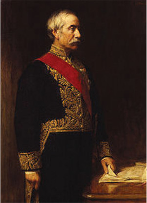
Why do you need 27-foot wide footpaths? "So that 100 years later if roads need to be widened, there will be space to do so,” replied Sir Henry Bartle Frere, governor of Bombay presidency (1862-67) and this city’s most dedicated urban planner who envisaged Bombay as the "Urbs Prima in Indis (India’s premier city).”
This nugget of information, provided by Dr Rekha Ranade, Professor of History at the University of Poona, was a part of the contour map of Bombay rolled out by the architects and professors of architecture and history who participated in the two-day seminar "Architecture as social history: Reflections on Bombay/Mumbai” organized by the K. R. Cama Oriental Institute (KRCOI) with a handsome grant from the MMR — Heritage Conservation Society, January 23 and 24, 2010. The seminar had been organized on behalf of the KRCOI by Rajiv Mishra, principal in-charge of the Sir J. J. College of Architecture and member of the governing body of the KRCOI and Dr Nawaz Mody, joint honorary secretary of the Institute.
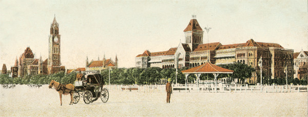
Top: Sir Henry Bartle Frere ; Above: Public buildings viewed from Cooperage
Bombay was in British hands for nearly two centuries before Bartle Frere, a civil servant, arrived on the scene. Part of the dowry of Catherine of Braganza who wed England’s Charles II in 1661, it had been Portuguese territory whose legacy of churches, forts and seminaries was a part of the landscape of western India. For four years the Portuguese in India continued to hold on to Bombay and when the final orders came from the king of Portugal, his viceroy in Goa remonstrated, "Only the obedience I owe Your Majesty as a vassal could have forced me to do this deed (cessation of the island) because I see great troubles that from this neighborhood will result to the Portuguese and that India will be lost on the same day in which the English nation is settled in Bombay,” Prof Aban Sethna, visiting lecturer at the VJTI (Victoria Jubilee Technical Institute) and IIT (Indian Institute of Technology), Powai after her retirement from Sir J. J. School of Architecture, quoted from Stephen Edward’s The Rise of Bombay.
Since the Portuguese colonial enterprise was launched during the feudal age when religious sanction was essential for any commercial or military enterprise, a prominent cross marked every construction, noted Agnes de Sa, head of the department of history at the L. S. Raheja College of Arts and Commerce. Every "achievement in the Portuguese annals was inspired, performed and crowned by the sign of the Cross…The island city and Salsette were once conspicuous for the numerous crosses. They were in every street and bylane…These relics of Portuguese influence were constructed on lonely roads to preserve the living from a multitude of ghosts,” said de Sa.
It was in the Manor House of Garcia d’Orta, the first physician to live in Bombay, that the British signed the instrument of possession in 1665, stated de Sa. Also referred to as the Quinta, remnants of the structure still survive in the INS Angre, an area now in the possession of the Indian Navy. The British fortified the remains and called it Bombay Castle and used it as the Governor’s House before it was converted into an arsenal, she adds.
Reflecting on the social conditions of the times, de Sa described the old bungalows in the so called Catholic enclaves like Kotachiwadi with "delicately fretworked eaves and verandahs” and the Indo-Portuguese feature known as the ‘balcao,’ small seats built into the steps to a verandah where "a visitor from a lower caste (who) could not enter the house would be permitted (to sit).” Verandahs and balconies meant for leisurely visiting and conversations where women too could join, marked the transition from an introverted, courtyard-centric lifestyle to a more outward looking one.
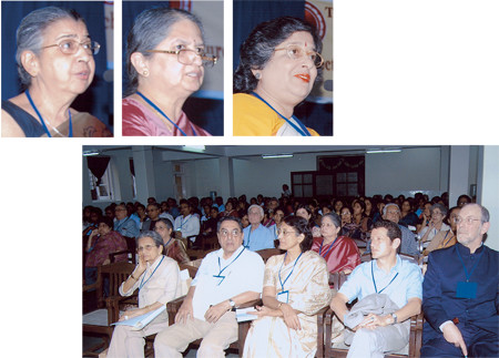
Above (L to R): Prof Aban Sethna, Dr Rekha Ranade, Agnes De Sa and a view of the audience (bottom)
To protect the "quiet trade so dear to their heart,” from the depredations of the Dutch, the Siddi, the Marathas and "perfidious Portugal,” the British built the Bombay Fort. "Spasmodically built,” beginning 1715, it "was completed — windows, curtains, glacis and all in 1745.” Its nucleus was the Bombay Castle as the old Manor House was now called. "To begin with it was warehouse, priory, fort and residence of the governor, all rolled into one. It remained the administrative headquarters of the British for a long time — all government correspondence dated and signed ‘Bombay Castle… Built of strong hard stone, parts of it survive to date behind the Town Hall/Asiatic Library,” said Sethna.
In their first dispatch after Bombay was transferred to the East India Company, its directors from London ordered that a harbor with docks be built and an armed vessel of 180 tons stationed there for defense and protection. "The brick and stone built Naval Dockyard enshrines history dating back to Portuguese time when Nuno de Cunha, the Portuguese viceroy of Goa, selected the present site of the Dockyard I Mody Bay as a place of safe anchorage in 1531,” notes Sethna.
Among the earliest British structures built within the Fort was the Court of Judicature. Designed and built by Gerald Aungier, the second governor of Bombay, it dispensed justice on trade and customs duty disputes until 1720. A mint, a printing press and a small hospital were other structures built in the area.
The manpower required to build the Fort and its urban infrastructure was lured from the mainland: "Weavers of calicoes — money spinners for British traders — were assured of ready built houses. Craftsmen were offered loans and other provisions. Goldsmiths, ironsmiths, tile makers, carpenters, bricklayers — all were wanted and welcomed. Initially they were allowed to occupy any vacant land. Bhatias, Banias, Shevni Brahmins, Parsis trooped into Bombay.” The protection of the Fort, employment opportunities and total religious toleration was a magnetic draw versus Aurangzeb’s anti-Hindu policies, taxes and the chaos of conflict with Shivaji’s forces, noted Sethna.
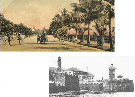
Above: Queen’s Road and Bombay Castle;
The building of the Fort wall and fortifications resulted in heavy expenditure and imposts like a ground tax and house tax were levied to meet the costs. Even so, the inhabitants and merchants felt so secure that they voluntarily agreed to pay an additional duty of two percent to fortify the town and the fear of Maratha attack in 1739 led the principal merchants to subscribe Rs 30,000 towards the construction of a moat called the Maratha Ditch, Sethna informed the audience. The Fort’s twin was the Esplanade "which stretched in an arc from Cooperage in the South to Carnac Road (now Lokmanya Tilak Marg) in the north,” level ground free of trees and permanent habitation so that the guns atop the Fort walls could fire unhindered, explained Sethna.
Progressively, over the years, Bombay came to be divided into two parts: English and Black. "By 1772 the Council decided that Churchgate was a proper place for Europeans... Natives were prevented from repairing their structures so that they would sell out to Europeans. Native shopkeepers were ordered to move to the Black Town” and it was officially decreed that "south of the north side of Churchgate Street” was white territory where only the large, rich and established Indian traders could afford to live and continue business. One such residential structure was Jamsetjee Jejeebhoy’s elaborately furnished Fort House where lavish parties embraced the cream of British society in Bombay.
The Black Town, with its haphazard growth, high human density and lack of hygiene where many natives lived cheek by jowl with their stables and stores, witnessed many a fire and visitation of epidemics. A Special Committee appointed to examine native residences suggested the restriction of the height of structures, the removal of all shop projections and the widening of streets to 50 feet, cross streets to 20 feet and gullies and lanes to 15 feet. Nevertheless, the great fire of 1803 reduced three quarters of the town to ashes. Houses, godowns, business premises, churches, temples, markets and barracks went up in flames, recounted Sethna.
The growth of the town outpaced the regulations that were enacted after the fire and the search for land to build was further complicated by the fast expanding railway network. The booming economy of Bombay got a further fillip as the opening of the Suez Canal made it the first port of call for ships from the West.
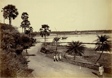
Backbay 1870
The Fort walls that had sheltered the town and its trade in earlier years now became an impediment. Queen Victoria’s Secretary of State agreed to the demolition with a rider: the style and character of the buildings to be erected on the created space had to be approved before the land was sold. "An opportunity, not likely to recur, will now be afforded of building a whole new city (on) the island of Bombay and it may become a permanent subject of national reproach, if due advantage be not taken of this occasion,” Sethna quoted Her Majesty’s Secretary of State from the archives. Ventilation, drainage, public health became the new guideposts of the government of Bombay. Enter Sir Bartle Frere.
He asked for a report on sanitary conditions. It recommended the shifting of burial grounds, the reclamation of marshes, banned tanneries in the city. By 1867 the mortality rate had diminished, noted Ranade. The reclamation of land from the sea proceeded simultaneously, undertaken by the government along the coast from the Custom House to Sewri, estimated at 1,500 acres or four million square yards, as per Ranade. "Like Augustus Caesar, Bartle Frere had the ambition to re-create Bombay. More hospitals and schools were founded in his time. He encouraged public philanthropy. He demanded wide roads with wide footpaths and shady trees. He insisted on the architectural style of the buildings and had a running argument with the Government of India which protested against the expenses: ‘If a new building, why not a beautiful one?’”
A gleaming array of high profile public buildings came up on the Esplanade: the Secretariat, the High Court, the Central PWD (public works department) Building, each a Victorian Gothic symbol of "strength, vision and permanence,” stated Ranade. Land values on the Esplanade rose from zero to dizzy heights. Plots and bungalows for high ranking civil and military personnel came up on New Marine Lines. "The center of political gravity shifted from within the one-time Fort to land outside it. South Bombay’s status and prestige catapulted to heights from which it has not been dislodged till today — BKC (Bandra-Kurla Complex) notwithstanding,” noted Sethna.
The four maidans the city boasts today were laid out then — Cooperage, Cross, Oval and Azad, where cricket, polo, golf and hockey as well as equestrian recreation were the order of the day. But each institution allotted these grounds had to pay a fee for its use as well as water, cut, roll and maintain the same, said Sethna.
There was no place for the poor in "sanitized South Bombay.” It was decreed that "they move north, towards Agripada and Jacob Circle and commute to South Bombay, courtesy the Tramway Company with whom arrangements for cheap fares and suitable services could be made,” quoted Sethna.
To be continued
◆ ◆ ◆
From the archive